
普洱镇 topographic map
Interactive map
Click on the map to display elevation.
About this map
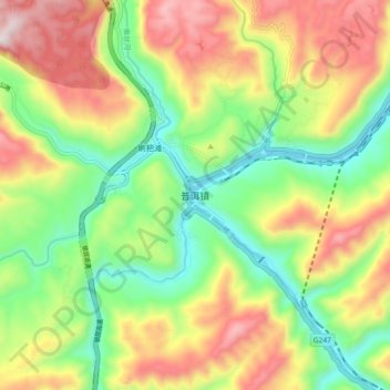
Name: 普洱镇 topographic map, elevation, terrain.
Location: 普洱镇, 昭通市, 云南省, 中国 (28.20862 104.12357 28.28862 104.20357)
Average elevation: 681 m
Minimum elevation: 353 m
Maximum elevation: 1,116 m
Other topographic maps
Click on a map to view its topography, its elevation and its terrain.