
泗水镇 topographic map
Interactive map
Click on the map to display elevation.
About this map
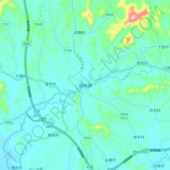
Name: 泗水镇 topographic map, elevation, terrain.
Location: 泗水镇, 茂名市, 广东省, 中国 (21.81546 110.92155 21.89546 111.00155)
Average elevation: 71 m
Minimum elevation: 30 m
Maximum elevation: 307 m
Other topographic maps
Click on a map to view its topography, its elevation and its terrain.