
黄泥镇 topographic map
Interactive map
Click on the map to display elevation.
About this map
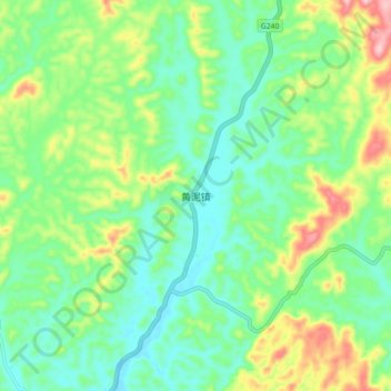
Name: 黄泥镇 topographic map, elevation, terrain.
Location: 黄泥镇, 永兴县, 郴州市, 湖南省, 中国 (26.16806 113.10549 26.24806 113.18549)
Average elevation: 163 m
Minimum elevation: 103 m
Maximum elevation: 293 m
Other topographic maps
Click on a map to view its topography, its elevation and its terrain.