
凤凰乡 topographic map
Interactive map
Click on the map to display elevation.
About this map
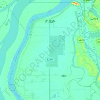
Name: 凤凰乡 topographic map, elevation, terrain.
Location: 凤凰乡, 屈原管理区, 汨罗市, 岳阳市, 湖南省, 中国 (28.88544 112.86987 29.00167 112.98522)
Average elevation: 27 m
Minimum elevation: 18 m
Maximum elevation: 81 m
Other topographic maps
Click on a map to view its topography, its elevation and its terrain.