
龙门乡 topographic map
Interactive map
Click on the map to display elevation.
About this map
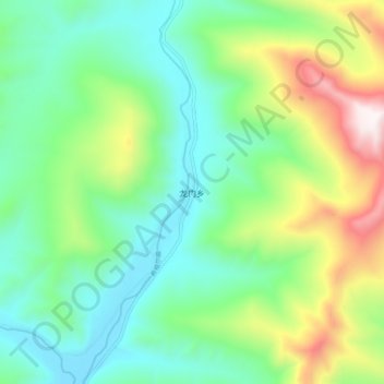
Name: 龙门乡 topographic map, elevation, terrain.
Location: 龙门乡, 天峻县, 海西蒙古族藏族自治州, 青海省, 中国 (37.83891 98.78346 37.91891 98.86346)
Average elevation: 4,101 m
Minimum elevation: 3,782 m
Maximum elevation: 4,860 m
Other topographic maps
Click on a map to view its topography, its elevation and its terrain.