
景阳镇 topographic map
Interactive map
Click on the map to display elevation.
About this map
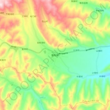
Name: 景阳镇 topographic map, elevation, terrain.
Location: 景阳镇, 大通回族土族自治县, 西宁市, 青海省, 中国 (36.76443 101.59694 36.84443 101.67694)
Average elevation: 2,638 m
Minimum elevation: 2,435 m
Maximum elevation: 2,910 m
Other topographic maps
Click on a map to view its topography, its elevation and its terrain.