
八寺崖村 topographic map
Interactive map
Click on the map to display elevation.
About this map
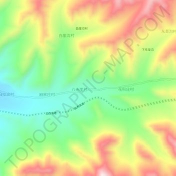
Name: 八寺崖村 topographic map, elevation, terrain.
Location: 八寺崖村, 大通回族土族自治县, 西宁市, 青海省, 中国 (36.94546 101.76766 36.98546 101.80766)
Average elevation: 2,837 m
Minimum elevation: 2,623 m
Maximum elevation: 3,103 m