
龙湖区 topographic map
Interactive map
Click on the map to display elevation.
About this map
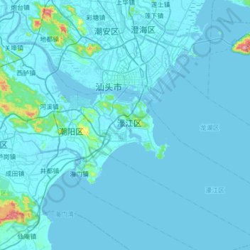
Name: 龙湖区 topographic map, elevation, terrain.
Location: 龙湖区, 汕头市, 广东省, 515041, 中国 (23.08526 116.69414 23.47451 117.22996)
Average elevation: 16 m
Minimum elevation: -3 m
Maximum elevation: 547 m
Other topographic maps
Click on a map to view its topography, its elevation and its terrain.