
谷饶镇 topographic map
Interactive map
Click on the map to display elevation.
About this map
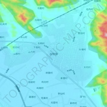
Name: 谷饶镇 topographic map, elevation, terrain.
Location: 谷饶镇, 汕头市, 广东省, 中国 (23.30986 116.36000 23.38986 116.44000)
Average elevation: 31 m
Minimum elevation: 1 m
Maximum elevation: 318 m
Other topographic maps
Click on a map to view its topography, its elevation and its terrain.