
太平镇 topographic map
Interactive map
Click on the map to display elevation.
About this map
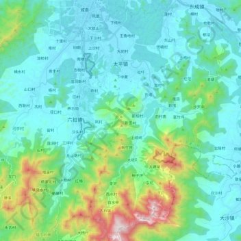
Name: 太平镇 topographic map, elevation, terrain.
Location: 太平镇, 新兴县, 云浮市, 广东省, 中国 (22.49612 112.21808 22.69531 112.34553)
Average elevation: 228 m
Minimum elevation: 25 m
Maximum elevation: 1,135 m
Other topographic maps
Click on a map to view its topography, its elevation and its terrain.