
惠济区 topographic map
Interactive map
Click on the map to display elevation.
About this map
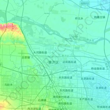
Name: 惠济区 topographic map, elevation, terrain.
Location: 惠济区, 郑州市, 河南省, 中国 (34.79449 113.49139 34.97299 113.79254)
Average elevation: 100 m
Minimum elevation: 82 m
Maximum elevation: 226 m
Other topographic maps
Click on a map to view its topography, its elevation and its terrain.