
Mt Kitumbeine topographic map
Interactive map
Click on the map to display elevation.
About this map
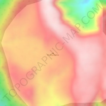
Name: Mt Kitumbeine topographic map, elevation, terrain.
Location: Mt Kitumbeine, Monduli, Arusha, Northern Zone, Tanzanie (-2.89373 36.21187 -2.89363 36.21197)
Average elevation: 2,694 m
Minimum elevation: 2,313 m
Maximum elevation: 2,841 m
Other topographic maps
Click on a map to view its topography, its elevation and its terrain.
Lac Natron
Lac Natron, Ngorongoro, Arusha, Northern Zone, Tanzanie
Average elevation: 861 m
Mount Meru
Mount Meru, Arumeru, Arusha, Northern Zone, Tanzanie
Average elevation: 3,884 m