
Mount Meru topographic map
Interactive map
Click on the map to display elevation.
About this map
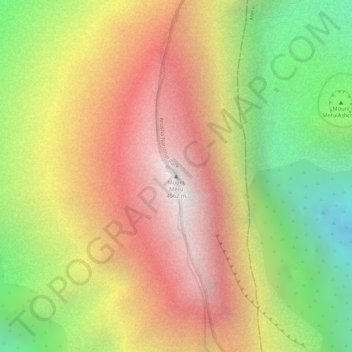
Name: Mount Meru topographic map, elevation, terrain.
Location: Mount Meru, Arumeru, Arusha, Northern Zone, Tanzanie (-3.24349 36.74978 -3.24339 36.74988)
Average elevation: 3,884 m
Minimum elevation: 3,068 m
Maximum elevation: 4,539 m
Other topographic maps
Click on a map to view its topography, its elevation and its terrain.
Lac Natron
Lac Natron, Ngorongoro, Arusha, Northern Zone, Tanzanie
Average elevation: 861 m
Mt Kitumbeine
Mt Kitumbeine, Monduli, Arusha, Northern Zone, Tanzanie
Average elevation: 2,694 m