
上庄镇 topographic map
Interactive map
Click on the map to display elevation.
About this map
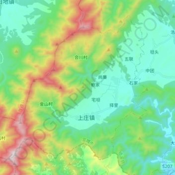
Name: 上庄镇 topographic map, elevation, terrain.
Location: 上庄镇, 绩溪县, 安徽省, 中国 (30.09582 118.34690 30.19267 118.48280)
Average elevation: 528 m
Minimum elevation: 187 m
Maximum elevation: 1,378 m
Other topographic maps
Click on a map to view its topography, its elevation and its terrain.