
临溪镇 topographic map
Interactive map
Click on the map to display elevation.
About this map
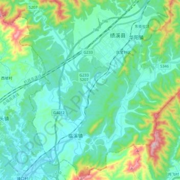
Name: 临溪镇 topographic map, elevation, terrain.
Location: 临溪镇, 绩溪县, 安徽省, 中国 (29.95511 118.48409 30.09678 118.61470)
Average elevation: 240 m
Minimum elevation: 121 m
Maximum elevation: 719 m
Other topographic maps
Click on a map to view its topography, its elevation and its terrain.