
白虎顶 topographic map
Interactive map
Click on the map to display elevation.
About this map
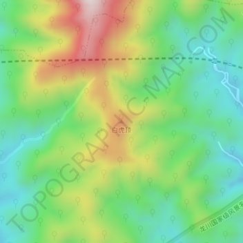
Name: 白虎顶 topographic map, elevation, terrain.
Location: 白虎顶, 瀛洲镇, 绩溪县, 安徽省, 中国 (30.10937 118.66439 30.10947 118.66449)
Average elevation: 453 m
Minimum elevation: 242 m
Maximum elevation: 814 m