
谷来镇 topographic map
Interactive map
Click on the map to display elevation.
About this map
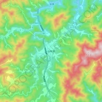
Name: 谷来镇 topographic map, elevation, terrain.
Location: 谷来镇, 绍兴市, 浙江省, 中国 (29.65202 120.59737 29.73202 120.67737)
Average elevation: 328 m
Minimum elevation: 83 m
Maximum elevation: 764 m
Other topographic maps
Click on a map to view its topography, its elevation and its terrain.