
次坞镇 topographic map
Interactive map
Click on the map to display elevation.
About this map
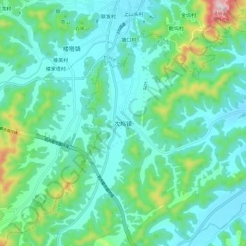
Name: 次坞镇 topographic map, elevation, terrain.
Location: 次坞镇, 绍兴市, 浙江省, 中国 (29.85032 120.11470 29.93032 120.19470)
Average elevation: 108 m
Minimum elevation: 14 m
Maximum elevation: 479 m
Other topographic maps
Click on a map to view its topography, its elevation and its terrain.