
Make a donation
Hainan Province topographic map
Click on the map to display elevation.
Make a donation
Hainan Province
Even while Hainan Island was a part of Guangdong it had a considerable amount of local autonomy; the southern half of the island was an autonomous prefecture. Hainan's elevation to provincial level in 1988 increased its accountability to the Central People's Government, but by designating the new province a special economic zone the central government expressed its intent to allow Hainan maximum flexibility in devising programs to facilitate foreign investment and economic growth. Administratively, the province has been divided into five economic major districts.
Make a donation
About this map
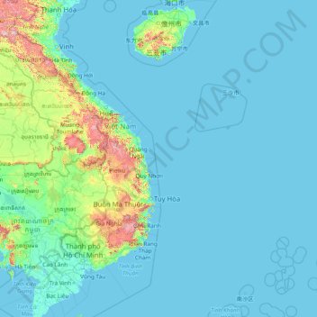
Name: Hainan Province topographic map, elevation, terrain.
Location: Hainan Province, China (8.66504 108.38823 20.34391 118.04440)
Average elevation: 95 m
Minimum elevation: -3 m
Maximum elevation: 2,518 m
Make a donation
Other topographic maps
Click on a map to view its topography, its elevation and its terrain.
Make a donation
Make a donation