
Yantai City topographic map
Interactive map
Click on the map to display elevation.
Yantai City
Yantai is located along the north coast of the Shandong Peninsula, south of the junction of Bohai Sea and Yellow Sea and parallel to the southern coast of Liaoning. The topographical breakdown consists of.
About this map
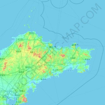
Name: Yantai City topographic map, elevation, terrain.
Location: Yantai City, Shandong, 264000, China (36.45070 119.54756 38.42078 121.92903)
Average elevation: 39 m
Minimum elevation: -2 m
Maximum elevation: 877 m