
Thank you for supporting this site ❤️
Make a donation
Make a donation
Tashbulaq topographic map
Click on the map to display elevation.
Thank you for supporting this site ❤️
Make a donation
Make a donation
About this map
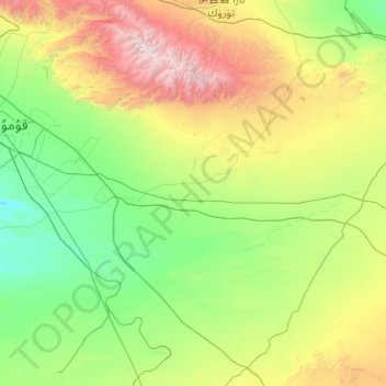
Name: Tashbulaq topographic map, elevation, terrain.
Location: Tashbulaq, Yizhou District, Hami, Xinjiang, China (42.05680 94.04407 43.05076 95.98780)
Average elevation: 1,408 m
Minimum elevation: 558 m
Maximum elevation: 4,836 m
Thank you for supporting this site ❤️
Make a donation
Make a donation