
小屯山 topographic map
Interactive map
Click on the map to display elevation.
About this map
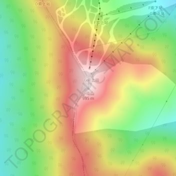
Name: 小屯山 topographic map, elevation, terrain.
Location: 小屯山, 吉林市, 吉林省, 中国 (43.65820 126.61935 43.65830 126.61945)
Average elevation: 623 m
Minimum elevation: 357 m
Maximum elevation: 915 m
Other topographic maps
Click on a map to view its topography, its elevation and its terrain.