
Thank you for supporting this site ❤️
Make a donation
Make a donation
Moulton topographic map
Click on the map to display elevation.
Thank you for supporting this site ❤️
Make a donation
Make a donation
About this map
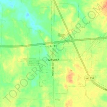
Name: Moulton topographic map, elevation, terrain.
Location: Moulton, Lawrence County, Alabama, 35650, United States (34.45524 -87.31683 34.51545 -87.24890)
Average elevation: 198 m
Minimum elevation: 180 m
Maximum elevation: 215 m
Thank you for supporting this site ❤️
Make a donation
Make a donation
Other topographic maps
Click on a map to view its topography, its elevation and its terrain.