
Green Bluff Mountain topographic map
Interactive map
Click on the map to display elevation.
About this map
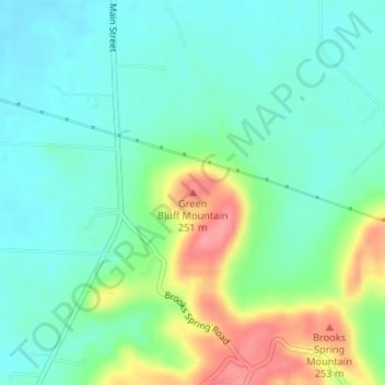
Name: Green Bluff Mountain topographic map, elevation, terrain.
Average elevation: 198 m
Minimum elevation: 171 m
Maximum elevation: 259 m
Other topographic maps
Click on a map to view its topography, its elevation and its terrain.
Speake
United States > Alabama > Lawrence County
Speake, Lawrence County, Alabama, United States
Average elevation: 197 m
Moulton
United States > Alabama > Lawrence County
Moulton, Lawrence County, Alabama, 35650, United States
Average elevation: 198 m
Mount Hope
United States > Alabama > Lawrence County
Mount Hope, Lawrence County, Alabama, 35651, United States
Average elevation: 194 m
Sipsey Wilderness
United States > Alabama > Lawrence County
Sipsey Wilderness, Lawrence County, Alabama, United States
Average elevation: 254 m