
则查洼 topographic map
Interactive map
Click on the map to display elevation.
About this map
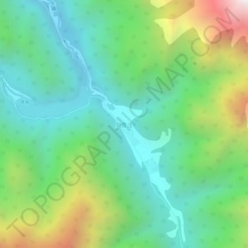
Name: 则查洼 topographic map, elevation, terrain.
Location: 则查洼, 九寨沟县, 阿坝藏族羌族自治州, 四川省, 中国 (33.13946 103.89140 33.17946 103.93140)
Average elevation: 2,842 m
Minimum elevation: 2,304 m
Maximum elevation: 4,096 m
Other topographic maps
Click on a map to view its topography, its elevation and its terrain.