
盏西镇 topographic map
Interactive map
Click on the map to display elevation.
About this map
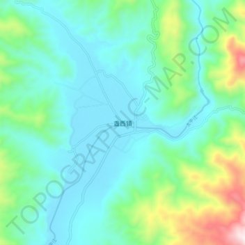
Name: 盏西镇 topographic map, elevation, terrain.
Location: 盏西镇, 盈江县, 德宏傣族景颇族自治州, 云南省, 665000, 中国 (25.02600 98.10860 25.10600 98.18860)
Average elevation: 1,195 m
Minimum elevation: 985 m
Maximum elevation: 1,979 m
Other topographic maps
Click on a map to view its topography, its elevation and its terrain.