
那邦镇 topographic map
Interactive map
Click on the map to display elevation.
About this map
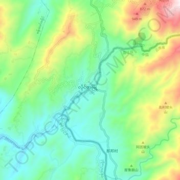
Name: 那邦镇 topographic map, elevation, terrain.
Location: 那邦镇, 盈江县, 德宏傣族景颇族自治州, 云南省, 665000, 中国 (24.71220 97.52039 24.79220 97.60039)
Average elevation: 470 m
Minimum elevation: 162 m
Maximum elevation: 1,173 m
Other topographic maps
Click on a map to view its topography, its elevation and its terrain.