
南桥街道 topographic map
Interactive map
Click on the map to display elevation.
About this map
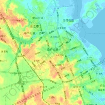
Name: 南桥街道 topographic map, elevation, terrain.
Location: 南桥街道, 湛江市, 广东省, 中国 (21.23322 110.33391 21.27428 110.41835)
Average elevation: 19 m
Minimum elevation: -9 m
Maximum elevation: 48 m
Other topographic maps
Click on a map to view its topography, its elevation and its terrain.