
固阳县 topographic map
Interactive map
Click on the map to display elevation.
About this map
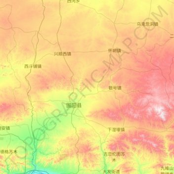
Name: 固阳县 topographic map, elevation, terrain.
Location: 固阳县, 包头市, 内蒙古自治区, 014000, 中国 (40.72386 109.63155 41.50238 110.73692)
Average elevation: 1,574 m
Minimum elevation: 1,079 m
Maximum elevation: 2,320 m
Other topographic maps
Click on a map to view its topography, its elevation and its terrain.