
卜尔汉图镇 topographic map
Interactive map
Click on the map to display elevation.
About this map
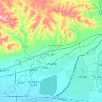
Name: 卜尔汉图镇 topographic map, elevation, terrain.
Location: 卜尔汉图镇, 昆都仑区, 包头市, 内蒙古自治区, 014000, 中国 (40.61852 109.60675 40.76031 109.81030)
Average elevation: 1,194 m
Minimum elevation: 1,015 m
Maximum elevation: 1,734 m
Other topographic maps
Click on a map to view its topography, its elevation and its terrain.