
小勐统镇 topographic map
Interactive map
Click on the map to display elevation.
About this map
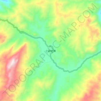
Name: 小勐统镇 topographic map, elevation, terrain.
Location: 小勐统镇, 临沧市, 云南省, 中国 (24.16780 99.24530 24.24780 99.32530)
Average elevation: 1,689 m
Minimum elevation: 1,267 m
Maximum elevation: 2,323 m
Other topographic maps
Click on a map to view its topography, its elevation and its terrain.