
桑日县 topographic map
Interactive map
Click on the map to display elevation.
About this map
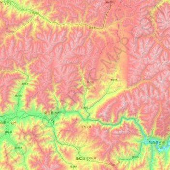
Name: 桑日县 topographic map, elevation, terrain.
Location: 桑日县, 山南市, 西藏自治区, 中国 (29.00736 91.84331 29.82561 92.59919)
Average elevation: 4,688 m
Minimum elevation: 3,177 m
Maximum elevation: 5,981 m
Other topographic maps
Click on a map to view its topography, its elevation and its terrain.