
日喀则市 topographic map
Interactive map
Click on the map to display elevation.
About this map
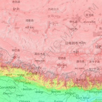
Name: 日喀则市 topographic map, elevation, terrain.
Location: 日喀则市, 西藏自治区, 中国 (27.21205 82.09907 31.80997 90.34500)
Average elevation: 3,772 m
Minimum elevation: 23 m
Maximum elevation: 8,097 m
Other topographic maps
Click on a map to view its topography, its elevation and its terrain.