
目若村 topographic map
Interactive map
Click on the map to display elevation.
About this map
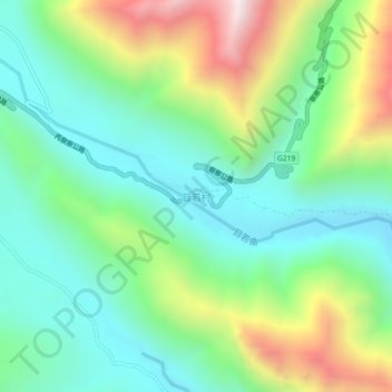
Name: 目若村 topographic map, elevation, terrain.
Location: 目若村, 察隅县, 林芝市, 西藏自治区, 中国 (28.56198 97.99365 28.60198 98.03365)
Average elevation: 4,056 m
Minimum elevation: 3,721 m
Maximum elevation: 4,783 m
Other topographic maps
Click on a map to view its topography, its elevation and its terrain.