
文教河 topographic map
Interactive map
Click on the map to display elevation.
About this map
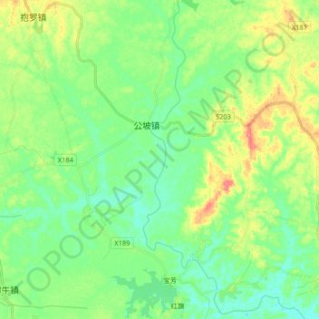
Name: 文教河 topographic map, elevation, terrain.
Location: 文教河, 文昌市, 海南省, 中国 (19.69767 110.80230 19.85111 110.88511)
Average elevation: 22 m
Minimum elevation: -2 m
Maximum elevation: 66 m
Other topographic maps
Click on a map to view its topography, its elevation and its terrain.