
漯河市 topographic map
Interactive map
Click on the map to display elevation.
About this map
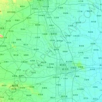
Name: 漯河市 topographic map, elevation, terrain.
Location: 漯河市, 河南省, 中国 (33.40300 113.44928 33.98608 114.29024)
Average elevation: 66 m
Minimum elevation: 49 m
Maximum elevation: 246 m
Other topographic maps
Click on a map to view its topography, its elevation and its terrain.