
澄源乡 topographic map
Interactive map
Click on the map to display elevation.
About this map
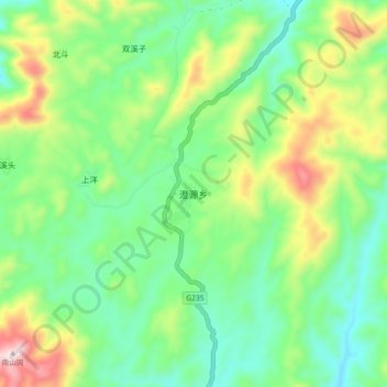
Name: 澄源乡 topographic map, elevation, terrain.
Location: 澄源乡, 南平市, 福建省, 中国 (27.27923 119.11622 27.35923 119.19622)
Average elevation: 1,047 m
Minimum elevation: 860 m
Maximum elevation: 1,441 m
Other topographic maps
Click on a map to view its topography, its elevation and its terrain.