
阿嘎如泰苏木 topographic map
Interactive map
Click on the map to display elevation.
About this map
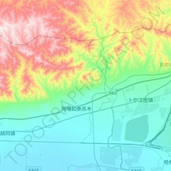
Name: 阿嘎如泰苏木 topographic map, elevation, terrain.
Location: 阿嘎如泰苏木, 九原区, 包头市, 内蒙古自治区, 014000, 中国 (40.62287 109.39478 40.74896 109.64948)
Average elevation: 1,278 m
Minimum elevation: 1,006 m
Maximum elevation: 1,937 m
Other topographic maps
Click on a map to view its topography, its elevation and its terrain.