
龙田乡 topographic map
Interactive map
Click on the map to display elevation.
About this map
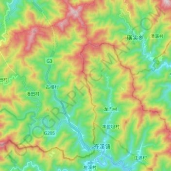
Name: 龙田乡 topographic map, elevation, terrain.
Location: 龙田乡, 休宁县, 黄山市, 安徽省, 中国 (29.42086 118.17865 29.52139 118.31184)
Average elevation: 612 m
Minimum elevation: 273 m
Maximum elevation: 1,202 m
Other topographic maps
Click on a map to view its topography, its elevation and its terrain.