
官桥镇 topographic map
Interactive map
Click on the map to display elevation.
About this map
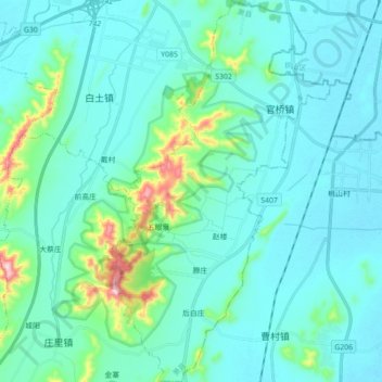
Name: 官桥镇 topographic map, elevation, terrain.
Location: 官桥镇, 萧县, 宿州市, 安徽省, 中国 (33.98565 117.03882 34.13197 117.14272)
Average elevation: 77 m
Minimum elevation: 27 m
Maximum elevation: 392 m
Other topographic maps
Click on a map to view its topography, its elevation and its terrain.