
沙园街道 topographic map
Interactive map
Click on the map to display elevation.
About this map
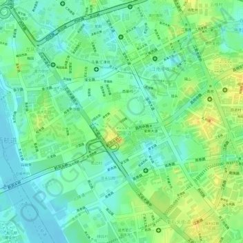
Name: 沙园街道 topographic map, elevation, terrain.
Location: 沙园街道, 海珠区, 广州市, 广东省, 510250, 中国 (23.08239 113.24650 23.09600 113.26514)
Average elevation: 14 m
Minimum elevation: -1 m
Maximum elevation: 31 m
Other topographic maps
Click on a map to view its topography, its elevation and its terrain.