
浸潭镇 topographic map
Interactive map
Click on the map to display elevation.
About this map
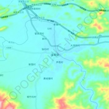
Name: 浸潭镇 topographic map, elevation, terrain.
Location: 浸潭镇, 清远市, 广东省, 中国 (24.02659 112.76711 24.10659 112.84711)
Average elevation: 110 m
Minimum elevation: 48 m
Maximum elevation: 435 m
Other topographic maps
Click on a map to view its topography, its elevation and its terrain.