
源汇区 topographic map
Interactive map
Click on the map to display elevation.
About this map
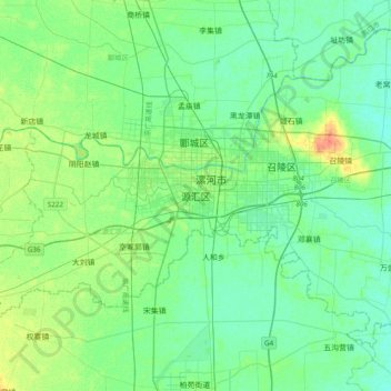
Name: 源汇区 topographic map, elevation, terrain.
Location: 源汇区, 漯河市, 河南省, 中国 (33.39711 113.85349 33.71711 114.17349)
Average elevation: 61 m
Minimum elevation: 52 m
Maximum elevation: 85 m
Other topographic maps
Click on a map to view its topography, its elevation and its terrain.