
怀头他拉 topographic map
Interactive map
Click on the map to display elevation.
About this map
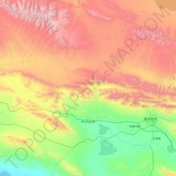
Name: 怀头他拉 topographic map, elevation, terrain.
Location: 怀头他拉, 德令哈市, 海西蒙古族藏族自治州, 青海省, 中国 (36.92351 95.71735 38.28172 97.14622)
Average elevation: 3,792 m
Minimum elevation: 2,680 m
Maximum elevation: 5,695 m
Other topographic maps
Click on a map to view its topography, its elevation and its terrain.