
蓄集乡 topographic map
Interactive map
Click on the map to display elevation.
About this map
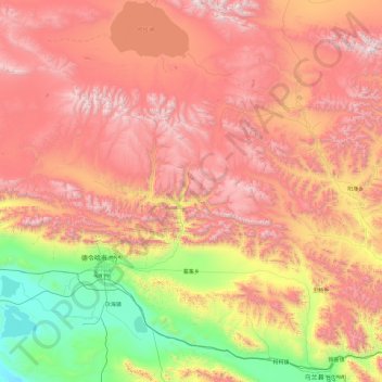
Name: 蓄集乡 topographic map, elevation, terrain.
Location: 蓄集乡, 德令哈市, 海西蒙古族藏族自治州, 青海省, 中国 (36.90372 97.10305 38.41879 98.14794)
Average elevation: 3,901 m
Minimum elevation: 2,790 m
Maximum elevation: 5,218 m
Other topographic maps
Click on a map to view its topography, its elevation and its terrain.