
尕海镇 topographic map
Interactive map
Click on the map to display elevation.
About this map
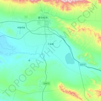
Name: 尕海镇 topographic map, elevation, terrain.
Location: 尕海镇, 德令哈市, 海西蒙古族藏族自治州, 青海省, 中国 (36.89132 97.17203 37.46805 97.79594)
Average elevation: 3,090 m
Minimum elevation: 2,821 m
Maximum elevation: 4,645 m