
前卫镇 topographic map
Interactive map
Click on the map to display elevation.
About this map
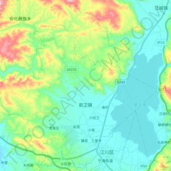
Name: 前卫镇 topographic map, elevation, terrain.
Location: 前卫镇, 江川区, 玉溪市, 云南省, 中国 (24.29827 102.63050 24.41090 102.80269)
Average elevation: 1,835 m
Minimum elevation: 1,707 m
Maximum elevation: 2,232 m
Other topographic maps
Click on a map to view its topography, its elevation and its terrain.