
青阳县 topographic map
Interactive map
Click on the map to display elevation.
About this map
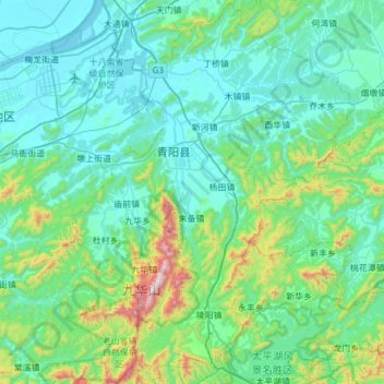
Name: 青阳县 topographic map, elevation, terrain.
Location: 青阳县, 池州市, 安徽省, 242800, 中国 (30.32303 117.67761 30.84597 118.12954)
Average elevation: 181 m
Minimum elevation: 0 m
Maximum elevation: 1,272 m
Other topographic maps
Click on a map to view its topography, its elevation and its terrain.