
白洋河 topographic map
Interactive map
Click on the map to display elevation.
About this map
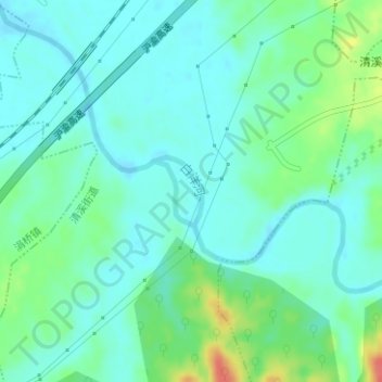
Name: 白洋河 topographic map, elevation, terrain.
Location: 白洋河, 池州市, 贵池区, 池州市, 安徽省, 247100, 中国 (30.58213 117.48115 30.58698 117.48511)
Average elevation: 22 m
Minimum elevation: 7 m
Maximum elevation: 65 m
Other topographic maps
Click on a map to view its topography, its elevation and its terrain.