
十王峰 topographic map
Interactive map
Click on the map to display elevation.
About this map
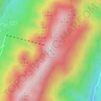
Name: 十王峰 topographic map, elevation, terrain.
Location: 十王峰, 池州市, 安徽省, 中国 (30.46338 117.81812 30.46348 117.81822)
Average elevation: 935 m
Minimum elevation: 457 m
Maximum elevation: 1,302 m
Other topographic maps
Click on a map to view its topography, its elevation and its terrain.